| |
The Role of Surveying
on the Juneau Icefield
Understanding the complex
dynamics of a glacial system requires fundamental
information such as the mass balance, depth and temperature
of the ice, meteorological conditions, surface velocity
vectors, strain rates, surface gradients, and changes in the
surface elevation. Integrating all these elements allows us
to evaluate the glaciodynamic response of the Juneau
Icefield with respect to climatic conditions, and to
possibly predict its future behavior.
The purpose of
the survey program is to measure, evaluate, and monitor, on
an annual basis, the surface velocity, strain rates, and
changes in the surface elevation of the Juneau Icefield.
Surface gradients along the longitudinal axis of the
glaciers are measured, and daily ablation rates are
determined. The data obtained from these measurements serve
as the foundation for determining the mode of flow and the
strain regime throughout the system. This, in conjunction
with annual measurements of the surface elevation, allow us
to answer questions such as "Are the glaciers getting
thicker or thinner? What is the spatial distribution pattern
of accumulation and ablation? Are the glaciers speeding up
or slowing down? Is the glacier system undergoing a
transition from one mode of flow to another? If so, could
this lead to advancement or recession of the glaciers
draining the Juneau Icefield?" Ultimately, the answers to
these questions may have an impact on the social, political,
and cultural dynamics of the area surrounding the Juneau
Icefield.
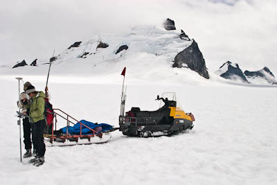
Students survey a point on the
Taku Glacier |
|
Where Do We Survey?
The main focus of the survey program is on the Taku Glacier
system. This includes the main trunk of the Taku Glacier and
its numerous tributaries - the Demorest, Hades Highway,
Southwest Branch, Northwest Branch, and Matthes Glaciers.
Other GPS surveys are conducted on the Lemon, Ptarmigan,
Gilkey, Llewellyn, and Cathedral Glaciers. Here's an
interactive map of the
Juneau Icefield showing the various glacier and mountain
names. This interactive map shows the locations of all the
GPS survey profiles.
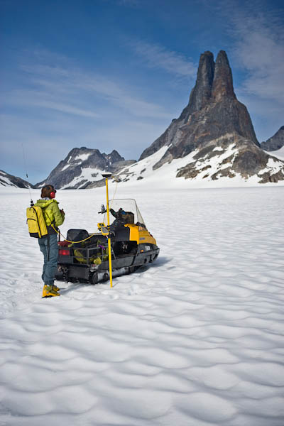
Surveying on Hades Highway, with
Michael's Sword in the background |
|