|
Annual Reports
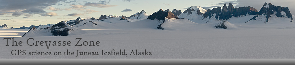
All the survey reports listed below detail the activities of
the JIRP survey program during the summer field seasons. These reports discuss
the methodology employed for the GPS surveys, identify the profiles surveyed, and
present the results of the survey work. Evaluation of the temporal and spatial
changes of movement vectors and surface elevation changes are also discussed. All data contained in these reports were
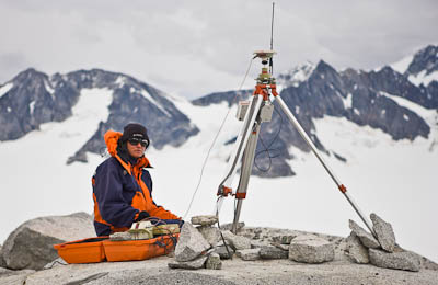
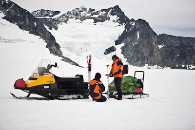
collected via static, rapid static, and real-time methods in differential mode.
 Geodetic Activities During the 1994 JIRP Field
Season (3.10 MB)
Geodetic Activities During the 1994 JIRP Field
Season (3.10 MB)
Geodetic Activities During the 1995 JIRP Field
Season (1.59 MB)
Geodetic Activities During the 1996 JIRP Field
Season (1.74 MB)
Geodetic Activities During the 1997 JIRP Field
Season (2.30 MB)
Geodetic Activities During the 1998 JIRP Field
Season (1.14 MB)
Geodetic Activities During the
1999 JIRP Field
Season (3.72 MB)
Geodetic Activities During the
2000 JIRP Field
Season (4.30 MB)
Geodetic Activities During the 2001 JIRP Field
Season (5.70 MB)
Geodetic Activities During the 2004 JIRP Field
Season (3.20 MB)
 JIRP
2007 Survey Summary (5 MB
PowerPoint presentation)
JIRP
2007 Survey Summary (5 MB
PowerPoint presentation)
|
Other Survey-related Reports
Geodetic Activities, Juneau Icefield, Alaska, 1981-1996 (103 MB)
This report summarizes survey activities on the Juneau Icefield from 1981
through 1996. It was compiled by Walter Welsch and Martin Lang.
Surface Velocity Changes on the Taku Glacier System - 1993 to 2007
(1.4 MB)
A
Comparison of Methods for Determining the Surface Mass Balance of a GPS Surveyed Movement
Profile (2.25 MB)
This paper evaluates two different methods of calculating volume and height
change across the areal extent of a surveyed plot. One method relies on the
interpolation and construction of a surface model via kriging. The other method
is non-interpolative, relying instead on only the observed surface height change
at each of the surveyed points.
Using GPS to Determine Local Surface Mass
Balance: A Case Study on the Taku Glacier, Alaska (0.64
MB)
This report applies the two methods described in the previous paper to the
surface elevation data collected at Profile 4 of the Taku Glacier, Juneau
Icefield, Alaska.
JIRP
Movement Profile Stake-out Coordinates (6.7 MB)
This booklet provides the Easting and Northing stake-out coordinates for all
GPS-surveyed profiles on the Juneau Icefield. The coordinates are used in the
annual establishment of the profiles with real-time GPS, thus ensuring that the
proper locations are surveyed for annual comparisons of surface velocity and
elevation. Last update: April, 2007.
|